

The components of an Intelligent Transport System (ITS) includes information‑technology, communications, and transportation engineering. The multidisciplinary blend is meant to make road networks safer, more efficient, and environmentally friendly. While the term sounds futuristic, every modern city already relies on a handful of concrete building blocks that enable real‑time decision‑making, seamless traveler information, and coordinated traffic control. Below you will find a detailed, formal overview of each component, written for a general audience that wishes to understand how ITS works, why each part matters, and how the pieces fit together to create a smarter mobility ecosystem.
1. Traffic Management Center (TMC)
Purpose – The TMC functions as the brain of the ITS. Trained operators monitor live feeds, assess congestion patterns, and dispatch corrective actions.
Key Elements
| Element | What It Does | Why It Matters |
|---|---|---|
| Operator Workstations | Display video, sensor data, and analytics dashboards. | Provide a unified view that lets staff spot incidents instantly. |
| Decision‑Support Software | Generate suggested signal timing, rerouting, or incident‑clearance actions. | Accelerates response, reducing delay and improving safety. |
| Communication Links | Connect the TMC to field devices, agencies, and the public. | Ensure that commands reach traffic signals, variable‑message signs, and mobile apps without delay. |
By keeping the TMC at the center of the network, the system maintains a constant feedback loop: field data flow in, operators analyze, and commands flow out.
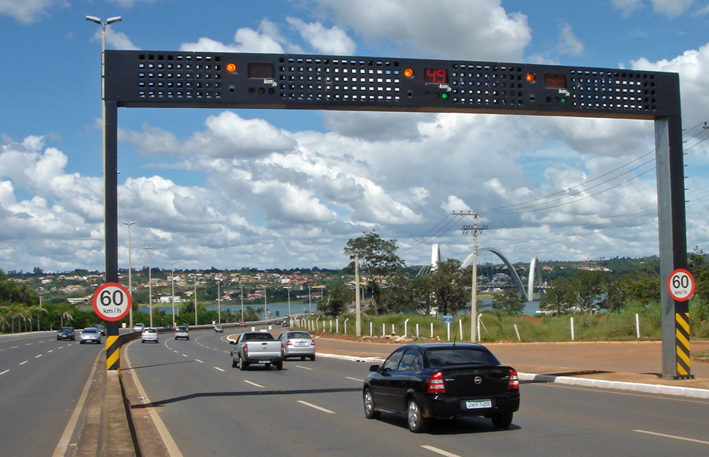
2. Field Devices and Sensors
Field devices capture the raw data that fuels every ITS function. They sit on or beside roadways, in transit vehicles, and at strategic crossroads.
a. Traffic Detectors
- Inductive Loops – Embedded copper wires detect vehicle presence by measuring changes in magnetic fields.
- Magnetometers – Surface‑mounted sensors sense disturbances in the Earth’s magnetic field caused by passing metal.
- Radar/Lidar Units – Emit radio or laser beams to measure vehicle speed, distance, and lane position.
These detectors feed precise volume, speed, and occupancy data to the TMC, enabling dynamic signal timing and congestion alerts.
b. Video Cameras
High‑definition cameras capture live footage for incident detection, license‑plate reading, and enforcement. Advanced video‑analytics software automatically flags stopped vehicles, illegal turns, or pedestrians in prohibited zones.
c. Environmental Sensors
Air‑quality monitors, weather stations, and road‑surface temperature sensors feed data that influences speed limits, de‑icing decisions, and emission‑reduction strategies.
d. Connected‑Vehicle Equipment
On‑board units (OBUs) installed in cars, buses, and trucks broadcast location, speed, and heading information via Dedicated Short‑Range Communications (DSRC) or Cellular‑V2X (C‑V2X). The system uses this data to predict traffic flow and issue personalized alerts.
3. Communication Infrastructure
Without a reliable, high‑speed network, the sensors, TMC, and end‑users cannot exchange information quickly enough to be useful.
| Sub‑Component | Function | Typical Technology |
|---|---|---|
| Fiber‑Optic Backbone | Carries massive data streams between control centers and field nodes. | Single‑mode fiber, 10–100 Gbps links |
| Wireless Access | Provides last‑mile connectivity for devices that cannot be hard‑wired. | DSRC, C‑V2X, LTE‑Advanced, 5G NR |
| Edge Gateways | Aggregate data from nearby sensors, perform initial filtering, and forward only relevant information. | Industrial‑grade routers, embedded PCs |
| Network Management Systems | Monitor link health, prioritize traffic, and enforce cybersecurity policies. | Software‑defined networking (SDN) platforms |
The communication layer guarantees that data moves from the field to the cloud—and back—within milliseconds, a prerequisite for real‑time control.
4. Data Processing, Storage, and Analytics
Raw sensor streams become actionable intelligence only after the system cleans, stores, and analyzes them.
a. Data Ingestion Engines
These pipelines pull data from detectors, cameras, and connected vehicles, convert formats, and timestamp each record. They handle high‑velocity streams, often exceeding hundreds of megabytes per second.
b. Centralized Data Lake
A scalable repository stores historical and real‑time data. Cloud‑based platforms such as Amazon S3, Microsoft Azure Blob, or on‑premise Hadoop clusters let engineers retain years of traffic patterns for trend analysis.
c. Analytics Modules
- Descriptive Analytics – Generate heat maps, congestion indices, and performance reports.
- Predictive Analytics – Apply machine‑learning models to forecast traffic volumes, travel times, and incident likelihood.
- Prescriptive Analytics – Recommend optimal signal plans, rerouting strategies, or demand‑management measures.
All analytics run on high‑performance computing clusters, ensuring that the TMC receives refreshed insights every few seconds.
5. Traffic‑Signal Control Systems
Traffic signals represent the most visible manifestation of ITS. Modern controllers adjust timing on the fly, balancing flow across intersecting corridors.
a. Adaptive Signal Control
The system evaluates real‑time detector data and automatically modifies green‑time allocation, cycle length, and phase sequence. By doing so, it reduces stops, cuts travel time, and lowers emissions.
b. Coordinated Corridor Control
Controllers synchronize a series of signals along a major arterial, creating “green waves” that allow platoons of vehicles to travel without stopping.
c. Emergency‑Vehicle Preemption
When a fire engine or ambulance approaches, the system detects its signal and grants a green light along its route, clearing a path in seconds.
d. Pedestrian‑Friendly Features
Push‑button detection, audible signals, and countdown timers improve safety and accessibility for walkers and cyclists.
All these capabilities rely on firmware that runs on robust, weather‑proof controller cabinets, often powered by redundant battery backups.
6. Traveler‑Information Systems
Informing drivers, passengers, and freight operators helps them make better choices, easing demand on congested roads.
a. Variable‑Message Signs (VMS)
Electronic billboards display dynamic messages about accidents, travel times, weather alerts, or lane closures. The TMC updates these signs in real time based on sensor inputs.
b. Mobile and In‑Vehicle Apps
Smartphone apps, navigation platforms, and in‑car infotainment systems receive OTA updates that include route suggestions, speed advisories, and parking availability. Integration with connected‑vehicle data makes the information highly personalized.
c. Public‑Transport Displays
Real‑time arrival boards at bus stops and train stations show exact vehicle ETAs, enabling smoother multimodal journeys.
d. Web Portals and Social Media
Public agencies publish dashboards, heat maps, and alerts on their websites and social channels, extending reach beyond roadside hardware.
7. Security, Privacy, and Resilience Measures
An ITS must protect both its data and its physical assets against cyber‑attacks, vandalism, and natural disasters.
- Encryption & Authentication – The radio signals employ TLS/DTLS encryption, while devices require digital certificates for mutual authentication.
- Intrusion‑Detection Systems (IDS) – Continuously monitor network traffic for anomalies, flagging potential breaches before they compromise operations.
- Redundant Architecture – Dual fiber paths, backup power supplies, and hot‑standby servers keep the system running even if a component fails.
- Data‑Privacy Policies – Anonymize vehicle identifiers and follow regional data‑protection regulations (e.g., GDPR, CCPA) to safeguard personal information.
By embedding security into every layer, the system maintains public trust and operational integrity.
8. Integration & Interoperability Frameworks
Cities rarely deploy a single, monolithic ITS. They assemble solutions from multiple vendors, each with its own standards. Interoperability ensures that these pieces speak the same language.
- Standardized Data Models – Use formats like DATEX II, TMDD (Traffic Management Data Dictionary), and SAE J2735 for message exchange.
- Open APIs – RESTful or SOAP interfaces let third‑party developers integrate new services (e.g., ride‑hailing platforms, freight‑routing tools).
- Middleware Platforms – Enterprise Service Buses (ESBs) and message brokers (e.g., Apache Kafka) orchestrate data flow between disparate subsystems.
- Regulatory Compliance – Align with national and regional guidelines, such as the U.S. Federal Highway Administration’s ITS Architecture or Europe’s ITS Directive.
A well‑engineered integration layer reduces vendor lock‑in, accelerates innovation, and future‑proofs the network.
9. Emerging Technologies and Future Enhancements
Intelligent transport systems evolve as new technologies mature. Planning for tomorrow’s upgrades keeps the infrastructure relevant for decades.
| Emerging Tech | Anticipated Impact |
|---|---|
| Artificial Intelligence (AI) at the Edge | Deploy AI models directly on roadside units to detect incidents instantly, without sending raw video to the cloud. |
| 5G‑Enabled Vehicle‑to‑Infrastructure (V2I) | Provide ultra‑low latency links that support cooperative adaptive cruise control and platooning. |
| Digital Twins | Create a virtual replica of the road network that runs parallel simulations, enabling planners to test policy changes before implementation. |
| Blockchain for Data Integrity | Record sensor readings on an immutable ledger, guaranteeing trust in audit trails for incident investigations. |
| Smart Parking Solutions | Combine occupancy sensors with dynamic pricing to guide drivers to the nearest available space, reducing cruising traffic. |
By monitoring these trends, agencies can schedule phased upgrades that integrate seamlessly with existing components.
How the Components Work Together – A Real‑World Scenario
- Morning Rush Begins – Magnetometers on a downtown corridor report rising vehicle counts.
- Data Ingestion Engine – Streams the detector readings to the analytics module within seconds.
- Predictive Model – Forecasts a queue that will spill onto a nearby arterial in five minutes.
- Traffic‑Signal Controller – Receives a pre‑emptive timing plan from the decision‑support software and extends green time on the main artery.
- Variable‑Message Sign – Displays “Heavy traffic ahead, consider alternate route.”
- Mobile App – Pushes a personalized reroute suggestion to drivers who have opted into the service.
- Connected Vehicles – Broadcast their adjusted speeds, allowing the system to refine its predictions in real time.
- TMC Operator – Monitors the situation on a workstation dashboard and, seeing the congestion dissipate, restores the original signal plan.
This closed loop—sensing, communicating, analyzing, acting, and informing—exemplifies the synergy among ITS components.
Benefits of a Fully Integrated ITS
- Reduced Travel Time – Adaptive signals and real‑time routing cut average trip durations by 10‑20 %.
- Lower Emissions – Smoother traffic flow reduces stop‑and‑go driving, cutting CO₂ output by up to 15 %.
- Improved Safety – Faster incident detection and emergency‑vehicle preemption lower crash rates.
- Enhanced Mobility Equity – Accessible pedestrian signals, real‑time transit information, and dynamic parking support all user groups.
- Data‑Driven Planning – Historical traffic datasets guide infrastructure investments, ensuring funds target the most critical bottlenecks.
Frequently Asked Questions (FAQ)
| Question | Answer |
|---|---|
| Do I need a special device to receive ITS information? | No. Most traveler‑information services appear in standard smartphone navigation apps, radio traffic reports, and roadside signs. |
| How does ITS protect my privacy? | The system anonymizes vehicle identifiers, encrypts all wireless communications, and follows local privacy regulations. |
| Can ITS work in rural areas? | Yes. A scaled‑down deployment uses fewer sensors and relies more on satellite‑based positioning and cellular networks, still delivering valuable real‑time updates. |
| What is the typical lifespan of field equipment? | Sensors and controllers are designed for 10–15 years of operation, with periodic firmware updates to extend functionality. |
| How does ITS handle power outages? | Critical devices incorporate battery backups and, where feasible, solar panels. Redundant fiber paths keep communications alive even if one link fails. |
End
Intelligent Transport Systems no longer belong to the realm of experimental research; they constitute the operational backbone of modern, livable cities. Understanding each component—traffic‑management centers, field sensors, communication networks, data analytics, signal controllers, traveler‑information platforms, security layers, integration frameworks, and emerging technologies—empowers citizens, planners, and policymakers to harness the full potential of smarter mobility. When every piece works in concert, the road network transforms from a source of frustration into an engine of efficiency, safety, and sustainability.
